
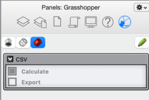
Once you have your geometry ready, open the grasshopper file. Once it finishes loading you can minimise the grasshopper window and use the Grasshopper panel in Rhino (right click on the panel and select Grasshopper if it’s not active. There are only two options: Calculate and Export. Press on Calculate to open the CSV Solution calculation window.
The CSV Solution window is where all the options and calculations take place. It is divided into eight tabs:
- Pj (CRS projection)
- Ot (geometry out)
- In (geometry in)
- CS (calculate convex spaces)
- CV (calculate convex voids)
- SV (calculate solid voids)
- Fc (visualise facades)
- Fl (visualise flows)
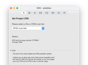
The window should open with the Pj (Projection) tab active. If not, select it. In this part, you will define the CRS that will be used throughout your project. You can either obtain it by reading from an existing shapefile .prj file, or you can attribute an EPSG code by selecting EPSG override. The script accepts most EPSG codes. In this example we enter 3763, for EPSG:3763 used in Portugal mainland. If successful, the status message will inform you of the CRS selected and you can continue with the next step.
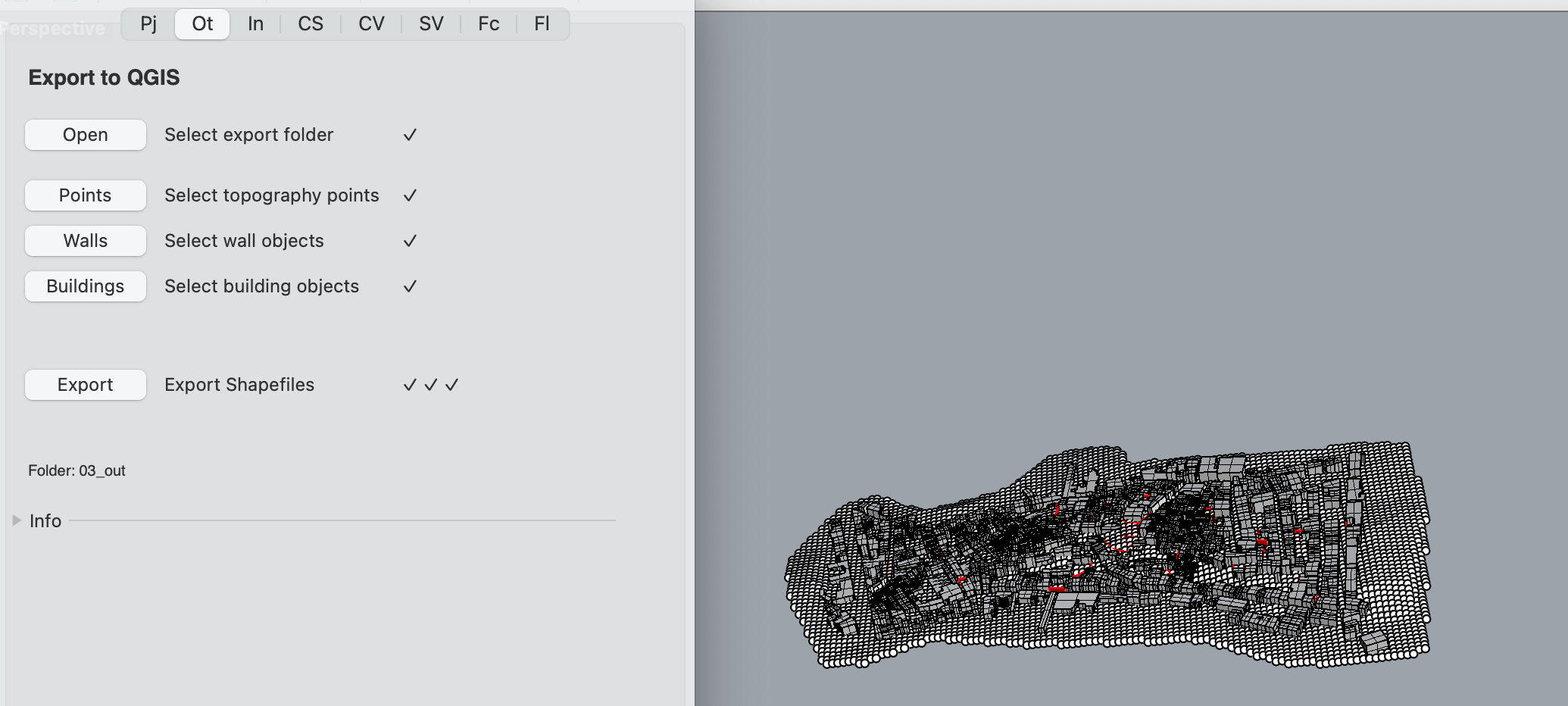
In this step, we select the Ot (output) tab to convert the rhino geometry to ESRI shapefiles. We need topography points,* building volumes (3D polygon BREPS representing buildings), other urban limit volumes (vertical planar BREP elements that represent all physical barriers such as gates, walls, hedges etc.), and if there is a shoreline, a polygon defining the water limit.* If the topography points are not sufficiently dense (please see screenshot), consider creating more through extrapolation (see Step 1 – Preparing the geometry).
We simply select the output folder to be used to export all the files, and then proceed to select the topography points, walls, and buildings, by clicking on the relevant button to activate the Rhino selection tool. Once all the selections have been made we click on export and wait for the process to finish.
* Water and other horizontal limits are still under development and not available at this time.